
Thank you for supporting this site ❤️
Make a donation
Make a donation
Chapman topographic map
Click on the map to display elevation.
Thank you for supporting this site ❤️
Make a donation
Make a donation
About this map
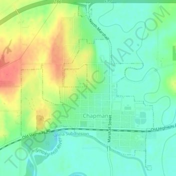
Name: Chapman topographic map, elevation, terrain.
Location: Chapman, Dickinson County, Kansas, 67431, United States (38.96380 -97.03722 38.98904 -97.01107)
Average elevation: 349 m
Minimum elevation: 328 m
Maximum elevation: 383 m
Thank you for supporting this site ❤️
Make a donation
Make a donation