
Udmaru topographic map
Interactive map
Click on the map to display elevation.
About this map
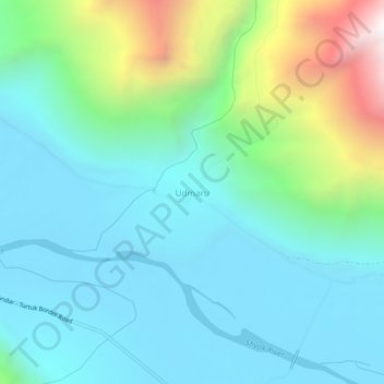
Name: Udmaru topographic map, elevation, terrain.
Location: Udmaru, Nubra, Leh district, Ladakh, India (34.68518 77.25085 34.72518 77.29085)
Average elevation: 3,376 m
Minimum elevation: 3,026 m
Maximum elevation: 4,595 m
Other topographic maps
Click on a map to view its topography, its elevation and its terrain.
Karakoram Pass
Karakoram Pass, Nubra, Leh District, Ladakh, India
Average elevation: 5,521 m
Siachen Glacier
Siachen Glacier, Nubra, Leh district, Ladakh, India
Average elevation: 5,448 m
Daulat Beg Oldi
Daulat Beg Oldi, Nubra, Leh district, Ladakh, India
Average elevation: 5,085 m