
Castillo topographic map
Interactive map
Click on the map to display elevation.
About this map
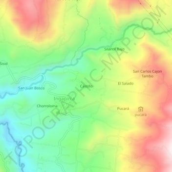
Name: Castillo topographic map, elevation, terrain.
Location: Castillo, Ingapirca, Cañar, Ecuador (-2.56127 -78.89161 -2.52127 -78.85161)
Average elevation: 3,216 m
Minimum elevation: 2,931 m
Maximum elevation: 3,601 m