
Évora topographic map
Interactive map
Click on the map to display elevation.
About this map
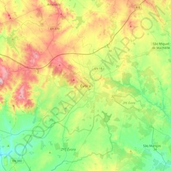
Name: Évora topographic map, elevation, terrain.
Location: Évora, 7000-530, Portugal (38.41077 -8.06928 38.73077 -7.74928)
Average elevation: 254 m
Minimum elevation: 150 m
Maximum elevation: 433 m
Evora est situé à 140 km a l'est de Lisbonne, dans la région de l'Alentejo, à une altitude de 304 mètres.
Other topographic maps
Click on a map to view its topography, its elevation and its terrain.