
Páez topographic map
Interactive map
Click on the map to display elevation.
About this map
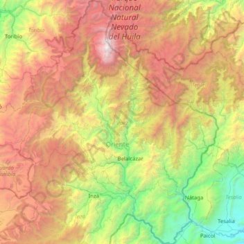
Name: Páez topographic map, elevation, terrain.
Location: Páez, Oriente, Cauca, Colombia (2.42695 -76.25474 3.04608 -75.74750)
Average elevation: 2,607 m
Minimum elevation: 722 m
Maximum elevation: 5,376 m
Other topographic maps
Click on a map to view its topography, its elevation and its terrain.
Nevado del Huila
Nevado del Huila, Páez, Oriente, Cauca, Colombia
Average elevation: 4,882 m
Guadualejo
Colombia > Cauca > Páez > Belalcázar > Guadualejo
Guadualejo, Belalcázar, Páez, Oriente, Cauca, Pacífica, Colombia
Average elevation: 1,472 m