
Thank you for supporting this site ❤️
Make a donation
Make a donation
Eurasburg topographic map
Click on the map to display elevation.
Thank you for supporting this site ❤️
Make a donation
Make a donation
About this map
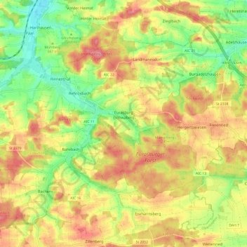
Name: Eurasburg topographic map, elevation, terrain.
Average elevation: 514 m
Minimum elevation: 469 m
Maximum elevation: 552 m
Thank you for supporting this site ❤️
Make a donation
Make a donation
Other topographic maps
Click on a map to view its topography, its elevation and its terrain.
Sankt Stephan
Germany > Bavaria > Landkreis Aichach-Friedberg > Sankt Stephan
Average elevation: 444 m
Thank you for supporting this site ❤️
Make a donation
Make a donation