
Río Túa topographic map
Interactive map
Click on the map to display elevation.
About this map
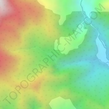
Name: Río Túa topographic map, elevation, terrain.
Location: Río Túa, Monterrey, Casanare, RAP Llanos, Colombia (5.01219 -72.91926 5.01801 -72.88947)
Average elevation: 1,358 m
Minimum elevation: 918 m
Maximum elevation: 1,930 m
Other topographic maps
Click on a map to view its topography, its elevation and its terrain.