
Faravohitra topographic map
Interactive map
Click on the map to display elevation.
About this map
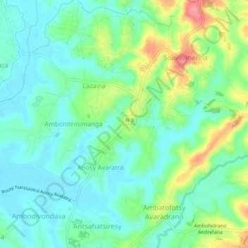
Name: Faravohitra topographic map, elevation, terrain.
Location: Faravohitra, Analamanga, Province d’Antananarivo, Madagascar (-18.83180 47.54663 -18.79180 47.58663)
Average elevation: 1,271 m
Minimum elevation: 1,245 m
Maximum elevation: 1,330 m