
Kirklees topographic map
Interactive map
Click on the map to display elevation.
About this map
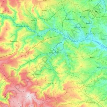
Name: Kirklees topographic map, elevation, terrain.
Average elevation: 220 m
Minimum elevation: 28 m
Maximum elevation: 581 m
Other topographic maps
Click on a map to view its topography, its elevation and its terrain.
West Yorkshire
Vereinigtes Königreich > England > Kirklees
West Yorkshire, Swincliffe Crescent, East Bierley, Kirklees, Yorkshire and the Humber, England, BD19 4BD, Vereinigtes Königreich
Average elevation: 172 m