
Plav topographic map
Interactive map
Click on the map to display elevation.
About this map
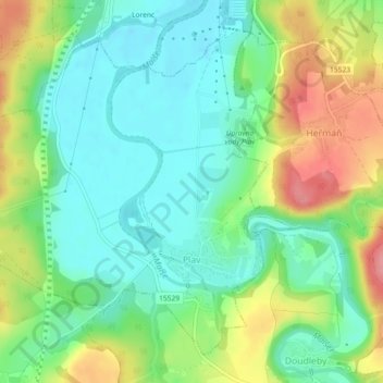
Name: Plav topographic map, elevation, terrain.
Location: Plav, okres České Budějovice, Southwest, Czechia (48.89397 14.45131 48.91955 14.49697)
Average elevation: 429 m
Minimum elevation: 394 m
Maximum elevation: 492 m
Other topographic maps
Click on a map to view its topography, its elevation and its terrain.
Šumava National Park
Šumava National Park, Zona 1, Horní Světlé Hory, Strážný, okres Prachatice, Jihočeský kraj, Southwest, 1384 92, Czechia
Average elevation: 801 m