
Thank you for supporting this site ❤️
Make a donation
Make a donation
Riner topographic map
Click on the map to display elevation.
Thank you for supporting this site ❤️
Make a donation
Make a donation
About this map
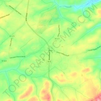
Name: Riner topographic map, elevation, terrain.
Location: Riner, Montgomery County, Virginia, United States (37.04652 -80.46061 37.08652 -80.42061)
Average elevation: 629 m
Minimum elevation: 570 m
Maximum elevation: 697 m
Thank you for supporting this site ❤️
Make a donation
Make a donation