
Eagle Rock topographic map
Interactive map
Click on the map to display elevation.
About this map
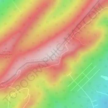
Name: Eagle Rock topographic map, elevation, terrain.
Location: Eagle Rock, Frederick County, Virginia, 22654, United States (39.11502 -78.45797 39.11512 -78.45787)
Average elevation: 602 m
Minimum elevation: 333 m
Maximum elevation: 783 m
Other topographic maps
Click on a map to view its topography, its elevation and its terrain.
Gore
United States > Virginia > Frederick County > Gore
Gore, Frederick County, Virginia, 22637, United States
Average elevation: 279 m