
Schouweiler topographic map
Interactive map
Click on the map to display elevation.
About this map
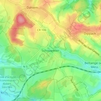
Name: Schouweiler topographic map, elevation, terrain.
Location: Schouweiler, Dippach, Canton Capellen, 4999, Luxembourg (49.56077 5.93731 49.60077 5.97731)
Average elevation: 341 m
Minimum elevation: 300 m
Maximum elevation: 399 m