
Legalameetse topographic map
Interactive map
Click on the map to display elevation.
About this map
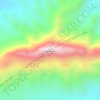
Name: Legalameetse topographic map, elevation, terrain.
Average elevation: 1,192 m
Minimum elevation: 883 m
Maximum elevation: 1,647 m
Other topographic maps
Click on a map to view its topography, its elevation and its terrain.
Kapama Game Reserve
South Africa > Limpopo > Mopani District Municipality > Maruleng Local Municipality
Average elevation: 536 m
Selati Nature Reserve
South Africa > Limpopo > Mopani District Municipality > Maruleng Local Municipality
Average elevation: 585 m