
Thank you for supporting this site ❤️
Make a donation
Make a donation
Lubec topographic map
Click on the map to display elevation.
Thank you for supporting this site ❤️
Make a donation
Make a donation
About this map
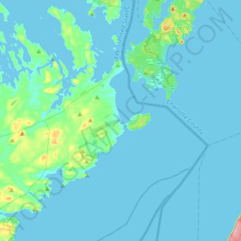
Name: Lubec topographic map, elevation, terrain.
Location: Lubec, Washington County, Maine, 04652, United States (44.71733 -67.11625 44.91087 -66.88541)
Average elevation: 9 m
Minimum elevation: -2 m
Maximum elevation: 112 m
Thank you for supporting this site ❤️
Make a donation
Make a donation
Other topographic maps
Click on a map to view its topography, its elevation and its terrain.
Thank you for supporting this site ❤️
Make a donation
Make a donation
Thank you for supporting this site ❤️
Make a donation
Make a donation
Thank you for supporting this site ❤️
Make a donation
Make a donation