
Thank you for supporting this site ❤️
Make a donation
Make a donation
Nabro topographic map
Click on the map to display elevation.
Thank you for supporting this site ❤️
Make a donation
Make a donation
About this map
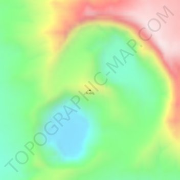
Name: Nabro topographic map, elevation, terrain.
Location: Nabro, Southern Red Sea Region, Eritrea (13.37463 41.69926 13.37473 41.69936)
Average elevation: 1,570 m
Minimum elevation: 1,345 m
Maximum elevation: 1,868 m
Thank you for supporting this site ❤️
Make a donation
Make a donation
Other topographic maps
Click on a map to view its topography, its elevation and its terrain.