
Thank you for supporting this site ❤️
Make a donation
Make a donation
Gatineau topographic map
Click on the map to display elevation.
Thank you for supporting this site ❤️
Make a donation
Make a donation
About this map
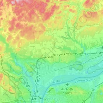
Name: Gatineau topographic map, elevation, terrain.
Location: Gatineau, Outaouais, Quebec, Canada (45.45174 -75.76877 45.57731 -75.52618)
Average elevation: 107 m
Minimum elevation: 28 m
Maximum elevation: 284 m
Thank you for supporting this site ❤️
Make a donation
Make a donation
Other topographic maps
Click on a map to view its topography, its elevation and its terrain.