
Quen topographic map
Interactive map
Click on the map to display elevation.
About this map
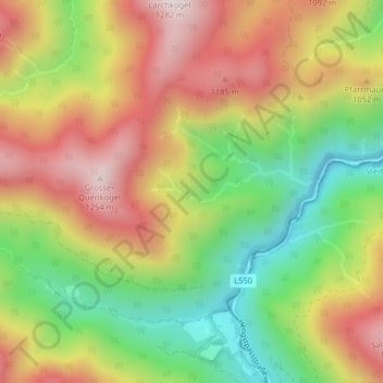
Name: Quen topographic map, elevation, terrain.
Location: Quen, Weyer, Bezirk Steyr-Land, 3335, Autriche (47.70168 14.50730 47.72168 14.52730)
Average elevation: 914 m
Minimum elevation: 588 m
Maximum elevation: 1,248 m