
Thank you for supporting this site ❤️
Make a donation
Make a donation
Castaños topographic map
Click on the map to display elevation.
Thank you for supporting this site ❤️
Make a donation
Make a donation
About this map
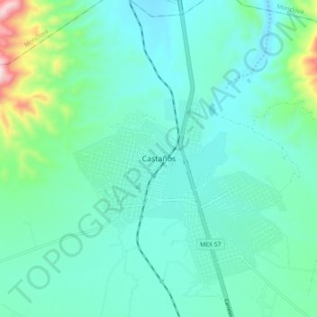
Name: Castaños topographic map, elevation, terrain.
Location: Castaños, Coahuila, Mexico (26.75433 -101.46870 26.83433 -101.38870)
Average elevation: 808 m
Minimum elevation: 693 m
Maximum elevation: 1,344 m
Thank you for supporting this site ❤️
Make a donation
Make a donation