
Thank you for supporting this site ❤️
Make a donation
Make a donation
Lindenhurst topographic map
Click on the map to display elevation.
Thank you for supporting this site ❤️
Make a donation
Make a donation
About this map
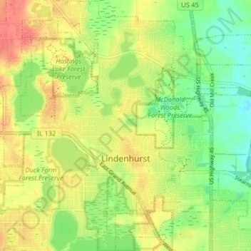
Name: Lindenhurst topographic map, elevation, terrain.
Location: Lindenhurst, Lake County, Illinois, United States (42.39267 -88.05865 42.44082 -88.00208)
Average elevation: 236 m
Minimum elevation: 211 m
Maximum elevation: 259 m
Thank you for supporting this site ❤️
Make a donation
Make a donation