
Thank you for supporting this site ❤️
Make a donation
Make a donation
Siantar Tua topographic map
Click on the map to display elevation.
Thank you for supporting this site ❤️
Make a donation
Make a donation
About this map
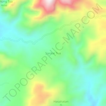
Name: Siantar Tua topographic map, elevation, terrain.
Location: Siantar Tua, South Tapanuli, North Sumatra, Sumatra, Indonesia (1.66521 99.35207 1.70521 99.39207)
Average elevation: 1,339 m
Minimum elevation: 1,063 m
Maximum elevation: 1,855 m
Thank you for supporting this site ❤️
Make a donation
Make a donation
Other topographic maps
Click on a map to view its topography, its elevation and its terrain.