
Santa Cruz topographic map
Interactive map
Click on the map to display elevation.
About this map
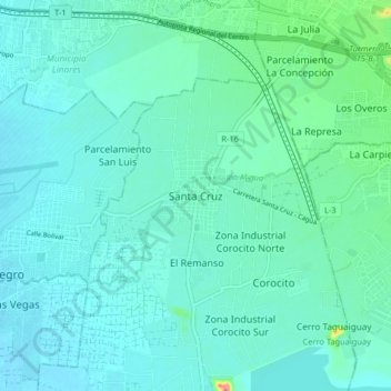
Name: Santa Cruz topographic map, elevation, terrain.
Average elevation: 445 m
Minimum elevation: 429 m
Maximum elevation: 537 m
Other topographic maps
Click on a map to view its topography, its elevation and its terrain.
Parroquia Santa Cruz
Venezuela > Estado Aragua > Municipio Lamas
Parroquia Santa Cruz, Municipio Lamas, Estado Aragua, 2123, Venezuela
Average elevation: 454 m