
Bukit Belungkor topographic map
Interactive map
Click on the map to display elevation.
About this map
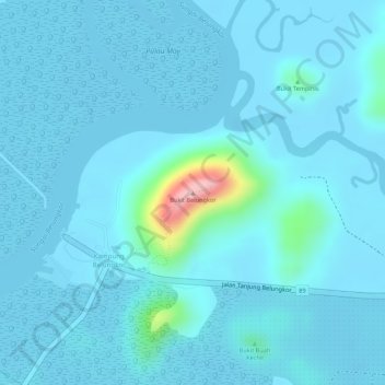
Name: Bukit Belungkor topographic map, elevation, terrain.
Location: Bukit Belungkor, Tanjung Surat, Kota Tinggi, Johor, Malaysia (1.45950 104.07503 1.45960 104.07513)
Average elevation: 15 m
Minimum elevation: -3 m
Maximum elevation: 173 m
Other topographic maps
Click on a map to view its topography, its elevation and its terrain.
Pulau Tanjung Surat
Malaysia > Johor > Tanjung Surat
Pulau Tanjung Surat, Tanjung Surat, Kota Tinggi, Johor, Malaysia
Average elevation: 5 m
Bukit Tempinis
Malaysia > Johor > Tanjung Surat
Bukit Tempinis, Tanjung Surat, Kota Tinggi, Johor, Malaysia
Average elevation: 15 m