
Thank you for supporting this site ❤️
Make a donation
Make a donation
Dibecik topographic map
Click on the map to display elevation.
Thank you for supporting this site ❤️
Make a donation
Make a donation
About this map
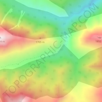
Name: Dibecik topographic map, elevation, terrain.
Location: Dibecik, Yüksekova, Hakkâri, Eastern Anatolia Region, Turkey (37.30579 43.96058 37.32579 43.98058)
Average elevation: 1,547 m
Minimum elevation: 1,174 m
Maximum elevation: 1,995 m
Thank you for supporting this site ❤️
Make a donation
Make a donation
Other topographic maps
Click on a map to view its topography, its elevation and its terrain.