
City of Syracuse topographic map
Interactive map
Click on the map to display elevation.
About this map
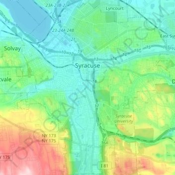
Name: City of Syracuse topographic map, elevation, terrain.
Average elevation: 172 m
Minimum elevation: 109 m
Maximum elevation: 354 m
Other topographic maps
Click on a map to view its topography, its elevation and its terrain.
Town of Manlius
Vereinigte Staaten von Amerika > New York > Onondaga County > Town of Manlius
Town of Manlius, Onondaga County, New York, Vereinigte Staaten von Amerika
Average elevation: 179 m