
Lerma topographic map
Interactive map
Click on the map to display elevation.
About this map
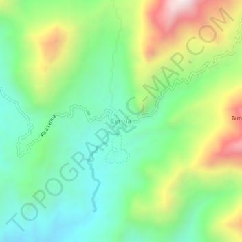
Name: Lerma topographic map, elevation, terrain.
Location: Lerma, Bolívar, Sur, Cauca, Colombia (1.95549 -76.97531 1.99549 -76.93531)
Average elevation: 1,251 m
Minimum elevation: 907 m
Maximum elevation: 1,902 m
Other topographic maps
Click on a map to view its topography, its elevation and its terrain.