
Deux-Montagnes topographic map
Interactive map
Click on the map to display elevation.
About this map
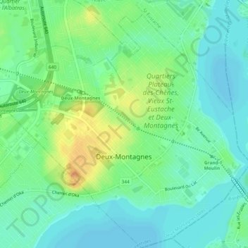
Name: Deux-Montagnes topographic map, elevation, terrain.
Location: Deux-Montagnes, Laurentides, Québec, Canada (45.52531 -73.92654 45.55874 -73.88065)
Average elevation: 30 m
Minimum elevation: 18 m
Maximum elevation: 51 m
Other topographic maps
Click on a map to view its topography, its elevation and its terrain.
Oka
Canada > Québec > Deux-Montagnes
Oka, Deux-Montagnes, Laurentides, Québec, J0N 1E0, Canada
Average elevation: 58 m
Parc national d'Oka
Canada > Québec > Deux-Montagnes > Pointe-Calumet
Parc national d'Oka, La Vagabonde, Pointe-Calumet, Deux-Montagnes, Laurentides, Québec, J0N 1M0, Canada
Average elevation: 48 m