
Thank you for supporting this site ❤️
Make a donation
Make a donation
Palm Beach County topographic map
Click on the map to display elevation.
Thank you for supporting this site ❤️
Make a donation
Make a donation
About this map
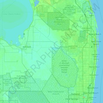
Name: Palm Beach County topographic map, elevation, terrain.
Location: Palm Beach County, Florida, United States (26.32068 -80.88623 26.97092 -79.97431)
Average elevation: 5 m
Minimum elevation: -3 m
Maximum elevation: 42 m
Thank you for supporting this site ❤️
Make a donation
Make a donation
Other topographic maps
Click on a map to view its topography, its elevation and its terrain.
Thank you for supporting this site ❤️
Make a donation
Make a donation
Bass Bay
United States > Florida > Charlotte County > Punta Gorda > Punta Gorda Isles
Average elevation: 2 m