
Thank you for supporting this site ❤️
Make a donation
Make a donation
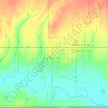
Hydro topographic map
Click on the map to display elevation.
Thank you for supporting this site ❤️
Make a donation
Make a donation
Hydro
Hydro is located near the northwestern corner of Caddo County at an elevation of 1,557 feet (475 m). A small part of the town extends north into Blaine County.
Thank you for supporting this site ❤️
Make a donation
Make a donation
About this map
Name: Hydro topographic map, elevation, terrain.
Location: Hydro, Caddo County, Oklahoma, United States (35.54399 -98.58856 35.55564 -98.57007)
Average elevation: 471 m
Minimum elevation: 447 m
Maximum elevation: 497 m
Thank you for supporting this site ❤️
Make a donation
Make a donation