
Fieldcrest topographic map
Interactive map
Click on the map to display elevation.
About this map
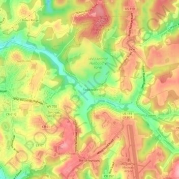
Name: Fieldcrest topographic map, elevation, terrain.
Average elevation: 347 m
Minimum elevation: 275 m
Maximum elevation: 399 m
Other topographic maps
Click on a map to view its topography, its elevation and its terrain.
Evansdale
United States > West Virginia > Monongalia County > Morgantown
Evansdale, Morgantown, Monongalia County, West Virginia, 26506, United States
Average elevation: 309 m