
Gompel topographic map
Interactive map
Click on the map to display elevation.
About this map
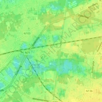
Name: Gompel topographic map, elevation, terrain.
Location: Gompel, Mol, Turnhout, Antwerpen, Vlaanderen, 2400, België (51.17279 5.13020 51.21279 5.17020)
Average elevation: 28 m
Minimum elevation: 17 m
Maximum elevation: 36 m
Other topographic maps
Click on a map to view its topography, its elevation and its terrain.
Ginderbuiten
België > Antwerpen > Turnhout > Mol
Ginderbuiten, Mol, Turnhout, Antwerpen, Vlaanderen, 2400, België
Average elevation: 27 m