
Thank you for supporting this site ❤️
Make a donation
Make a donation
Van Dyksbaai topographic map
Click on the map to display elevation.
Thank you for supporting this site ❤️
Make a donation
Make a donation
About this map
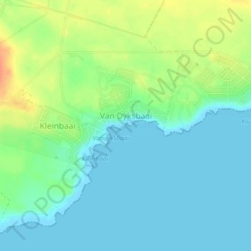
Name: Van Dyksbaai topographic map, elevation, terrain.
Average elevation: 14 m
Minimum elevation: 0 m
Maximum elevation: 42 m
Thank you for supporting this site ❤️
Make a donation
Make a donation
Other topographic maps
Click on a map to view its topography, its elevation and its terrain.
Kleinbaai
South Africa > Western Cape > Overberg District Municipality > Overstrand Local Municipality
Average elevation: 15 m
Pringle Bay Peak
South Africa > Western Cape > Overberg District Municipality > Overstrand Local Municipality
Average elevation: 35 m
Danger Point Lighthouse
South Africa > Western Cape > Overberg District Municipality > Overstrand Local Municipality
Average elevation: 6 m