
Kenmare Municipal District topographic map
Interactive map
Click on the map to display elevation.
About this map
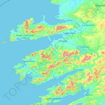
Name: Kenmare Municipal District topographic map, elevation, terrain.
Location: Kenmare Municipal District, County Kerry, Munster, Ireland (51.68820 -10.61844 52.33778 -9.27401)
Average elevation: 98 m
Minimum elevation: -3 m
Maximum elevation: 1,001 m