
Rupa topographic map
Click on the map to display elevation.
About this map
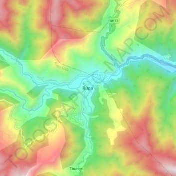
Name: Rupa topographic map, elevation, terrain.
Location: Rupa, Rupa SDO, West Kameng, Arunachal Pradesh, India (27.16390 92.35983 27.24390 92.43983)
Average elevation: 1,973 m
Minimum elevation: 1,368 m
Maximum elevation: 2,782 m
Other topographic maps
Click on a map to view its topography, its elevation and its terrain.