
Williams Township topographic map
Interactive map
Click on the map to display elevation.
About this map
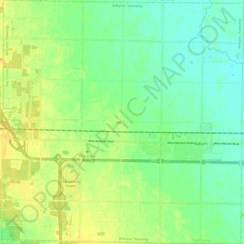
Name: Williams Township topographic map, elevation, terrain.
Location: Williams Township, Bay County, Michigan, United States (43.56731 -84.16812 43.65448 -84.04866)
Average elevation: 193 m
Minimum elevation: 182 m
Maximum elevation: 203 m
Other topographic maps
Click on a map to view its topography, its elevation and its terrain.
City of Essexville
United States > Michigan > Bay County
City of Essexville, Bay County, Michigan, United States
Average elevation: 180 m
City of Auburn
United States > Michigan > Bay County
City of Auburn, Bay County, Michigan, United States
Average elevation: 189 m
Bay City
United States > Michigan > Bay County
Bay City, Bay County, Michigan, 48708, United States
Average elevation: 181 m