
Srinagar topographic map
Interactive map
Click on the map to display elevation.
About this map
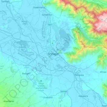
Name: Srinagar topographic map, elevation, terrain.
Average elevation: 1,805 m
Minimum elevation: 1,577 m
Maximum elevation: 4,024 m
La città è situata a 34° 4' 60 N e 74° 49' 0 E, a un'altitudine di 1554 m s.l.m., nella valle del Kashmir, su entrambe le sponde del fiume Jhelum, un affluente del fiume Indo.