
Thank you for supporting this site ❤️
Make a donation
Make a donation
Byron topographic map
Click on the map to display elevation.
Thank you for supporting this site ❤️
Make a donation
Make a donation
About this map
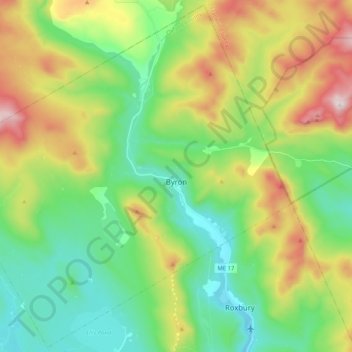
Name: Byron topographic map, elevation, terrain.
Location: Byron, Oxford County, Maine, 04275, United States (44.65346 -70.76923 44.79564 -70.56380)
Average elevation: 492 m
Minimum elevation: 211 m
Maximum elevation: 1,047 m
Thank you for supporting this site ❤️
Make a donation
Make a donation
Other topographic maps
Click on a map to view its topography, its elevation and its terrain.
Sturtevant Pond
United States > Maine > Oxford County > Magalloway Plantation
Average elevation: 406 m
Mad River Falls
United States > Maine > Oxford County > Batchelders Grant Township
Average elevation: 495 m
Thank you for supporting this site ❤️
Make a donation
Make a donation