
Province of Rodríguez de Mendoza topographic map
Interactive map
Click on the map to display elevation.
About this map
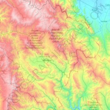
Name: Province of Rodríguez de Mendoza topographic map, elevation, terrain.
Location: Province of Rodríguez de Mendoza, Amazonas, Peru (-6.72678 -77.75226 -5.99972 -77.13230)
Average elevation: 2,196 m
Minimum elevation: 807 m
Maximum elevation: 3,985 m
Other topographic maps
Click on a map to view its topography, its elevation and its terrain.
San Cristóbal
Peru > Amazonas > San Cristóbal
San Cristóbal, Province of Luya, Amazonas, Peru
Average elevation: 2,283 m