
Kufra topographic map
Interactive map
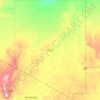
Click on the map to display elevation.
About this map
Name: Kufra topographic map, elevation, terrain.
Location: Kufra, Libya (19.49999 19.16810 27.04972 25.00389)
Average elevation: 555 m
Minimum elevation: 146 m
Maximum elevation: 3,336 m
Kufra's location in Libya's southeast places it on the country's border with Egypt, Sudan (unlike any other Libyan district), and Chad. It borders the following regions of these countries, namely, New Valley Governorate, Egypt in the east, Shamaliyah State, Sudan in southeast, North Darfur State, Sudan in the far southeast, Bourkou-Ennedi-Tibesti Region, Chad in the south. Domestically, it borders the following districts, namely, Murzuq in west, Jufra in northwest and Al Wahat in north. Kufra is a part of Cyrenacian geographical subdivision, the largest region in Libya and which is mostly semi arid in nature. The region receives an annual rainfall of 5 in (130 mm). There are no perennial rivers in the region, but the region is abundant with groundwater aquifers. All three regions of the county have mostly a flat undulating plain and occasional plateau, with an average elevation of around 423 m (1,388 ft). Around 91 per cent of the land is covered by desert, with only 8.8 per cent agricultural land (with only 1% arable lands) and 0.1 per cent of forests. It is desert climate in all other parts of the region. Dust storms lasting four to eight days are fairly common during Spring.
Other topographic maps
Click on a map to view its topography, its elevation and its terrain.
Ain Al-Alima - Ain Al-Ghazala
Libya > Butnan > Ain Al-Alima - Ain Al-Ghazala
Ain Al-Alima - Ain Al-Ghazala, Butnan, Libya
Average elevation: 23 m