
Thank you for supporting this site ❤️
Make a donation
Make a donation
Cuito topographic map
Click on the map to display elevation.
Thank you for supporting this site ❤️
Make a donation
Make a donation
Cuito
The town sits on the eastern flank of the Bie Plateau. The climate is unusually cool for its tropical location. The average annual temperature is 18 °C, largely due to its high altitude. The coolest period is May to August when almost no rain falls. September and October are the hottest months with a little rain. Heavy rain falls in the main rainy season November to April.
Thank you for supporting this site ❤️
Make a donation
Make a donation
About this map
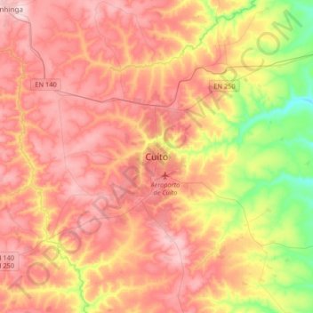
Name: Cuito topographic map, elevation, terrain.
Location: Cuito, Bié Province, Angola (-12.54313 16.78255 -12.22313 17.10255)
Average elevation: 1,671 m
Minimum elevation: 1,518 m
Maximum elevation: 1,789 m
Thank you for supporting this site ❤️
Make a donation
Make a donation