
St. Valentiner Bach topographic map
Interactive map
Click on the map to display elevation.
About this map
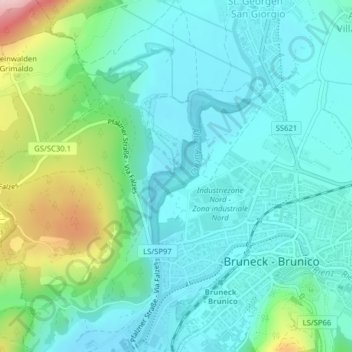
Name: St. Valentiner Bach topographic map, elevation, terrain.
Average elevation: 867 m
Minimum elevation: 809 m
Maximum elevation: 1,062 m
Other topographic maps
Click on a map to view its topography, its elevation and its terrain.
Hirschbrunnerbach - Rio di Fontecervo
Italie > Trentin-Haut-Adige > Bruneck - Brunico
Hirschbrunnerbach - Rio di Fontecervo, Bruneck - Brunico, Pustertal - Val Pusteria, Haut-Adige, Trentin-Haut-Adige, 39031, Italie
Average elevation: 1,567 m