
Thank you for supporting this site ❤️
Make a donation
Make a donation
Madison County topographic map
Click on the map to display elevation.
Thank you for supporting this site ❤️
Make a donation
Make a donation
About this map
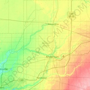
Name: Madison County topographic map, elevation, terrain.
Location: Madison County, Indiana, United States (39.94364 -85.86302 40.37968 -85.57539)
Average elevation: 270 m
Minimum elevation: 230 m
Maximum elevation: 336 m
Thank you for supporting this site ❤️
Make a donation
Make a donation
Other topographic maps
Click on a map to view its topography, its elevation and its terrain.