
Melkbosstrand topographic map
Interactive map
Click on the map to display elevation.
About this map
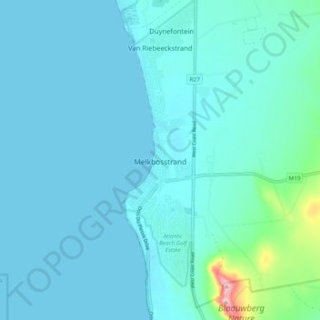
Name: Melkbosstrand topographic map, elevation, terrain.
Location: Melkbosstrand, City of Cape Town, Western Cape, South Africa (-33.76125 18.43524 -33.68239 18.45695)
Average elevation: 22 m
Minimum elevation: 0 m
Maximum elevation: 228 m