
Tharoul topographic map
Interactive map
Click on the map to display elevation.
About this map
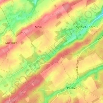
Name: Tharoul topographic map, elevation, terrain.
Location: Tharoul, Molu, Marchin, Hoei, Luik, Wallonië, 4570, België (50.41670 5.22651 50.45670 5.26651)
Average elevation: 232 m
Minimum elevation: 178 m
Maximum elevation: 269 m
Other topographic maps
Click on a map to view its topography, its elevation and its terrain.