
Boston topographic map
Interactive map
Click on the map to display elevation.
About this map
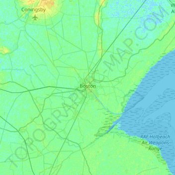
Name: Boston topographic map, elevation, terrain.
Location: Boston, Lincolnshire, England, Vereinigtes Königreich (52.86280 -0.24671 53.08666 0.23855)
Average elevation: 3 m
Minimum elevation: -2 m
Maximum elevation: 14 m
Other topographic maps
Click on a map to view its topography, its elevation and its terrain.
Baumber
Vereinigtes Königreich > England > Lincolnshire > East Lindsey
Baumber, East Lindsey, Lincolnshire, England, Vereinigtes Königreich
Average elevation: 46 m
Grantham
Vereinigtes Königreich > England > Lincolnshire > Grantham
Grantham, Lincolnshire, East Midlands, England, NG31 6PU, Vereinigtes Königreich
Average elevation: 87 m