
Berlin topographic map
Interactive map
Click on the map to display elevation.
About this map
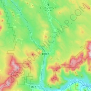
Name: Berlin topographic map, elevation, terrain.
Location: Berlin, Coös County, New Hampshire, 03570, United States (44.44506 -71.39786 44.52844 -71.12364)
Average elevation: 468 m
Minimum elevation: 209 m
Maximum elevation: 1,021 m