
Clemency topographic map
Interactive map
Click on the map to display elevation.
About this map
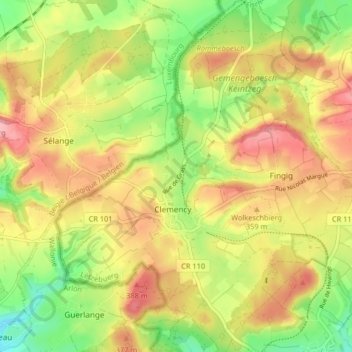
Name: Clemency topographic map, elevation, terrain.
Location: Clemency, Charage, Canton Capellen, Luxembourg (49.57621 5.84777 49.62922 5.90474)
Average elevation: 343 m
Minimum elevation: 279 m
Maximum elevation: 402 m
Other topographic maps
Click on a map to view its topography, its elevation and its terrain.
Bascharage
Bascharage, Charage, Canton Capellen, Luxembourg
Average elevation: 312 m