
Vila Chã topographic map
Interactive map
Click on the map to display elevation.
About this map
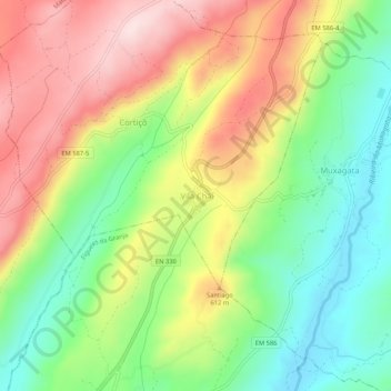
Name: Vila Chã topographic map, elevation, terrain.
Average elevation: 522 m
Minimum elevation: 361 m
Maximum elevation: 717 m
Other topographic maps
Click on a map to view its topography, its elevation and its terrain.
Cortiço
Portugal > Guarda > Cortiçô e Vila Chã > Cortiçô
Cortiço, Cortiçô, Cortiçô e Vila Chã, Fornos de Algodres, Guarda, Portugal
Average elevation: 614 m