
青岛市 topographic map
Interactive map
Click on the map to display elevation.
About this map
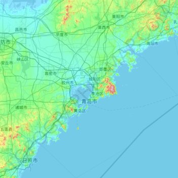
Name: 青岛市 topographic map, elevation, terrain.
Location: 青岛市, Shandong, China (35.21758 119.50922 37.14832 121.56990)
Average elevation: 37 m
Minimum elevation: -3 m
Maximum elevation: 1,072 m
Other topographic maps
Click on a map to view its topography, its elevation and its terrain.