
Thank you for supporting this site ❤️
Make a donation
Make a donation
Maquela do Zombo topographic map
Click on the map to display elevation.
Thank you for supporting this site ❤️
Make a donation
Make a donation
About this map
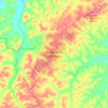
Name: Maquela do Zombo topographic map, elevation, terrain.
Location: Maquela do Zombo, Uíge Province, Angola (-6.10081 15.06750 -6.02081 15.14750)
Average elevation: 876 m
Minimum elevation: 813 m
Maximum elevation: 934 m
Thank you for supporting this site ❤️
Make a donation
Make a donation